Follow


Follow us with Map Share on Delorme In-Reach:
https://share.delorme.com/SummerPlace

Monday, July 22, 2013

Varney Bay

We had the head of Winter Harbour, which is a large area, all to ourselves last night and I think we found out why this morning. The anchor bridle, chain, and anchor were globed with sea grass. It took awhile to get it all off. We think the intake for the anchor wash was sucking it in also. Still working on removing the debris, we left Winter Harbour before it got sucked into the salt water intake for the engine. There is a little high fog with patches of blue sky as we departed at 10:20. Leaving the harbour Brad spots a raft of about 40 sea otters on the starboard side. We are so occupied looking at them with the binoculars that neither one of us thinks to take a picture. It is a lovely day with less than 10 knots of wind as we motor further into Quatsino Sound. We would take the time to put up the spinaker or perhaps put out the fishing pole, but we need to get to Quatsino Narrows before the tide changes. There are small fishing boats and large logs to look out for as we proceed. While traveling Brad cleans the permanent filters to the watermaker, as we are not making water today. This is quite a process. He has to remove the stairs and the carpet, go through a small hatch in the sole, close a through hole valve, then reaching into the cabinet under the sink in the galley, unscrew the two vessels which hold the filters and are full of water. Then he washes the filters and reverses the procedure. As we approach Quatsino Narrows there is some turbulence and we have a 4 knot push at the most. After the narrows it is just a hard starboard turn to arrive into Varney Bay at 14:10. Once securely anchored Brad investigates the cause of low water pressure in the sea water anchor wash down we had this morning. He discovers there is a filter for the system under the floor inside the sink cabinet in the forward head. Sure enough it has sea grass inside. It is working fine now. We lower the dinghy and put on the 9.9 horse motor. Brad is going fishing outside the bay as our anchorage is in a fish preserve. I sit back for a quiet afternoon of reading. Brad is back to the boat with no sign of fish, so I guess it's a good thing I just put the Pork Fried Rice in the oven to heat. Were going to run the generator for awhile and watch a little DVD before showers and bed. Today's stats: sea temp 53.6, outside temp 73, engine hours 4, nautical miles 25, total trip miles 577.4, GPS coordinates 50.33.303N / 127.31.711W.

----------
radio email processed by SailMail
for information see: http://www.sailmail.com


Sunday, July 21, 2013

Winter Harbour, Quatsino Sound, West Coast Vancouver Island

Last night Brad checked in with his folks by sat phone and called his coworker Shawn who was kind enough to pick up our vehicle in Seattle and drive to back to Coos Bay. Thanks Shawn!

Up at 05:00 this morning. We are setting the storm sails before pulling up the Anchor. Leaving Bull Harbour at 06:10. We have decided to cross the Nahwitti Bar instead of skirting around the reef close to shore at Cape Sutil as the guide book recommends, this was a good decision, as the bar was not rough. We are early as usual, but the boat handles well and the seas are not as rough as expected. We do have quite a lot of fog, so the running lights are on as well as the tri color, which I can't remember if it needs to be on when you are motoring. The storm stay sail has a bright florescent head. There isn't much traffic, but we want to be as visible as we can. As we are rounding Cape Scott, several small recreational vessels are zipping out in front of us to get to the fishing grounds at mid morning. The fog is still with us, but there is plenty of visibility. The engine is running a bit rough, so Brad switches over the the other fuel filter and changes the bad one while we are running, and the engine is back to purring along. About 14:00 the sun starts to peak through and we can see the shore clearly. The Wind has been an average of 10 knots, enough for the storm sails to stabilize the rocking of the boat a little, but not enough to use the genoa because it is directly astern on the course that we are following. We bounce into Quatsino Sound and motor up Forward Inlet looking for some place nice to drop the anchor. We settle on the head of Winter Bay and drop anchor at 15:40. There is much work to be done, putting the storm sails away and getting the sheets, halyards, running back stays, etc. put back to normal. Brad BBQs hotdogs on the grill tonight for dinner. I need to call home and then crash. Today's stats: sea temp 52.7, outside temp 67, engine hours 9.5, watermaker one hour, nautical miles 58.6, total trip miles 551, GPS coordinates 50.31.950N / 128.00.544W.

Note:  128"27'.404W furthest west this trip.

----------
radio email processed by SailMail
for information see: http://www.sailmail.com


Saturday, July 20, 2013

Bull Harbour, Hope Island

Ready to go, just passing time. We went to see the world's largest burl, very impressive. Played a little Yahtzee. Pushed off the dock at 13:15. We're following the coast of Vancouver Island, out Broughton Strait, Queen Charlotte Strait, past Port Hardy, through the Goletas Channel to Hope Island and Bull Harbour. This is one of the last places to find refuge before rounding Cape Scott and heading down the west side of Vancouver Island. The weather has been very good so far, overcast with low clouds. We couldn't have asked for much better. Not a lot to report today as we are basically moving to position ourselves for tomorrow's passage which will be a long one. We put down anchor at 19:20. Today's stats: sea temp 51.3, outside temp 59, engine hours 6.3, nautical miles 39.8, total miles 492.4, GPS coordinates 50.54.975N / 127.56.188W.

----------
radio email processed by SailMail
for information see: http://www.sailmail.com


Thursday, July 18, 2013

Port McNeill, Vancouver Island

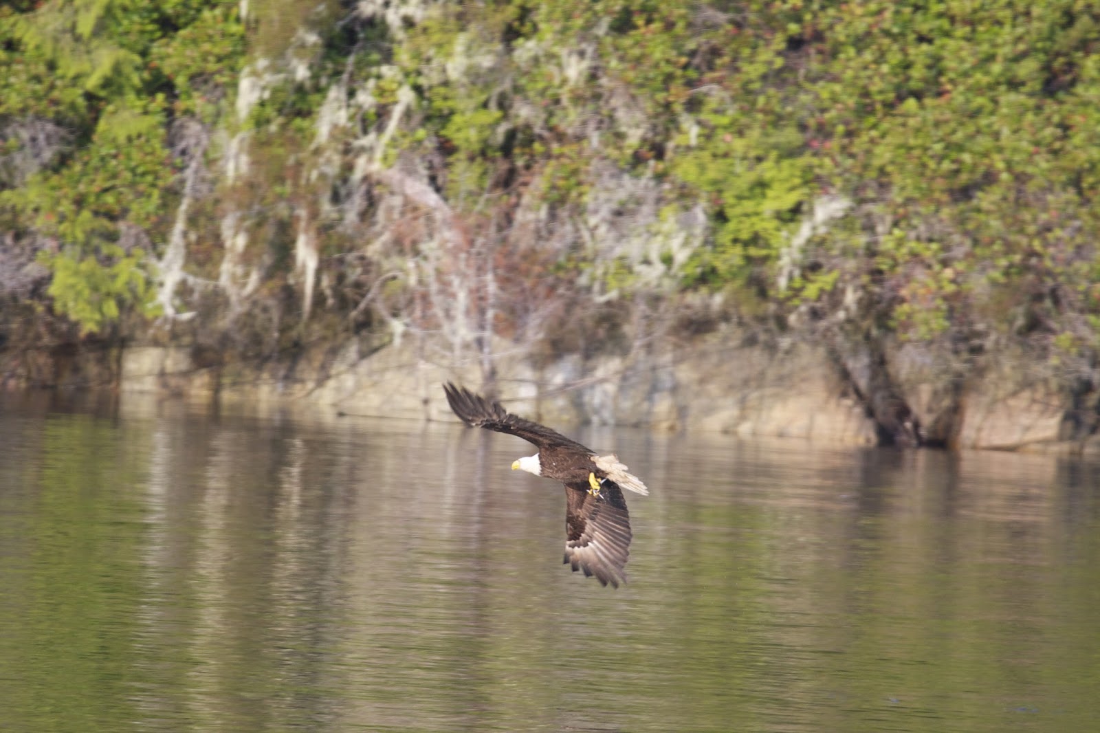
We were gently rocked to sleep last night by the few swells that made it into the bay.   The anchor took a while to bring up this morning as the chain had wrapped around the bridle and didn't want to come loose.  Around 09:45 we headed out to Queen Charlotte Strait to light fog and lighter breeze.  As we came into the opening, we were amazed as at least eight bald eagles were taking turns feeding on tiny fish that were boiling to the surface.  The eagles would swoop down and take  a few fish at a time in their talons.  A group of diver ducks where all around probably driving the fish into a concentrated area.  When the eagles were finished a flock of sea gulls started feeding using their beaks until the school had dissipated.  The strait has just enough wind to set the sails and proceed at a respectable 4.0 knots.  Brad put his fishing line out and we trolled along.  No luck today, but we did see salmon being cleaned at the docks in Port McNeill.  Upon reaching the Vancouver side, we put the sails away and proceeded to Sointula on Malcom Island.  The marina didn't look very promising and they didn't have fuel, so we left and made way for Port McNeill across Cormorant Channel.  Arriving at the marina we had a bit of a wait getting into the fuel docks.  Once in we took about 28 gallons at a price of $5.07 per gallon.  The staff here is very friendly and helpful.  We decide to stay the night.  Moorage is $1.10 per foot plus $7.00 for 30 amp electrical.  Brad washed the salt from the boat and filled the water tank, then we walked into town.  At an auto parts store we were able to purchase 10 more 10 micron fuel filters.  That should hold us for awhile as we head out into the ocean and stir up the fuel tank.   We're polishing the fuel now using the 2 micron filter as we set at the dock.  In town we also ate dinner at the pub which was a treat for both of us.  This is the first time eating out since Seattle and I'm not sure that counts as it was at the grocery store deli.  After dinner we walked to the IGA and got loonies (Canadian dollar coins) to do the wash tomorrow.  Todays stats:  Outside temp mid 60's, sea temp?, engine hours 3.8, sailed 1-2 hours,  nautical miles 24.1, total trip miles 452.6, GPS coordinates 50.35.501N /127.05.463W.
Sea Gull grabbing breakfast

Staying in Port McNeill at the marina for a second night.  Lots to do in town.  After cleaning the interior of the boat and applying rain ex to the cockpit windows, I started the laundry while Brad hits a few stores looking for fishing gear and boat parts.  After lunch we went back to town to grocery shop.  The Magna Cart is really coming in handy.  We talked to a fisherman on the docks who is catching Chinook at 150 ft. on sardines.  Boats left and new boats took their place.  We met a couple from Elliot Bay Marina who have been up north since May and are working their way down slowly.  Dinner out again at Gus' Pub.  I'm really starting to like Port McNeill


Port McNeil's Fuel Dock & Marina


Wednesday, July 17, 2013

Cullen Harbour, Broughton Island

Still whisper quiet in Turnbull Cove this morning. Delaying our departure time to correspond to slack tide in Booker Lagoon Passage, we pull up the anchor at 10:45 with some mud. We head back down Grappler Sound and into Wells Passage. The little breeze we had disappears as we enter Queen Charlotte Strait. So much for our plan to spend an hour sailing. As we approach Cullen Harbour at the bottom of Broughton Island Brad spots a couple of whales. They gently emerge to breath and then dive with a wave of their fluke. We decide to anchor in Cullen Harbour instead of Booker Lagoon as the current at the entrance to the lagoon complicates leaving in the morning. It is lovely here with only one other boat in view. We launch the dinghy and exchange the two horse for the 9.9 and head into Booker Lagoon. I have my second lesson at handling the dinghy which seems to respond better with this motor. While inside we spot a pod of dolphins and try to snap pictures as they swim by the dinghy. Next we take the dinghy out into Queen Charlotte Strait perhaps to get a glimpse of more whales, but watch a pair of bald eagles instead. Back at the boat Brad makes everything ship shape while I prepare dinner. Tonight is Chicken Broccoli Casserole, the last meal before we start to repeat the menu. Todays stats: sea temp 54.3, outside temp 70, engine hours 4.2, no sailing, watermaker 3 hours, nautical miles 22.8, total trip miles 428.3, GPS coordinates 50.46.480N / 126.44.461W.

----------
radio email processed by SailMail
for information see: http://www.sailmail.com
Cullen Harbour


Inside Booker Lagoon, Dolphins ahead of  dinghy

Exploring Cullen Harbour, Booker Lagoon

Entrance to Booker Lagoon


Tuesday, July 16, 2013

Laura Cove / Turnbull Cove

Surprisingly good night in Sargeaunt Passage. One other sailboat came in sometime and snuggled into a quiet nitch for the night. 09:08 anchor up from rocky bottom, little breeze, calm water, few low clouds, and sunshine. We continue up Tribune Channel, counterclockwise around Gilford Island. Stopping in to peak at Kwatsi Bay, It is very different from when we stayed here two years ago when the mist was heavy in the air and the cliffs were covered with waterfalls. Continuing we travel north of the Burdwood Group to Broughton Island. Our destination is Laura Bay. We arrive at 12:45 and anchor in the little cove next to Trivet Island with a stern tie to the shore. During this process, a passing dinghy asks if we know of any doctors in the area. Brad promises to make a "boat call" when we are secured. In the afternoon we take the dinghy out to fish. I have the pleasure of steering. As hard as I try, I cannot keep a straight direction of travel. That's probably why Brad catches the lovely bottom fish as we zig zagged our way around the outside of Trivett Island. Meatballs, garlic mashed potato and green beans for dinner. Todays stats: sea temp 58.8, outside temp 67, engine hours 5, nautical miles 22.4, total trip miles 387.6, one fuel filter changed, GPS coordinates 50.49.427N / 126.34.134W.

Last evening we decided to loosen up the stern tie and anchor out a little further so we can let out more rode. This morning we remain in a good position to let loose the stern tie and bring up the anchor from the rocky bottom as we head out at 10:00. Our heading, up Penphrase Passage, through Sharp Passage, into Sutlej Channel. From there we take Dunsany Passage, to Grappler Sound. As we turn east, we are treated to the spectacular view of what I believe to be Mount Stephens. Our destination is Turnbull Cove were we arrive at 12:45. We anchor on the east side well away from shore. There are two rock slides in this cove which we stay clear of as well as several other boats which we also give room. Plan to take the dinghy for a ride still and have BBQ hamburgers for dinner. Todays stats: sea temp 56.1, outside temp 78, engine hours 3, watermaker 2 hours, nautical miles 17.9, total trip miles 405.5, GPS coordinates 50.57.642N / 126.49.877W.

----------
radio email processed by SailMail
for information see: http://www.sailmail.com

Looking into Kwatsi Bay

Laura Cove, Stern Tie

Sushi?


Laura Cove


Becalmed

Major Landslide


Turnbull Cove


Monday, July 15, 2013

Sargeaunt Passage

07:45 Anchor up and on our way. Low clouds conceal the majestic mountain tops seen yesterday. Heading out Sunderland Channel, we want to go north in Johnstone Strait with the tide and before the wind picks up. We make the turn back east at Havannah Channel deciding to pass up Bougey Bay in hopes of

a better anchorage. We are officially in the Broughtons and the scenery has changed. It feels more isolated and the mountains seem closer. We turn into Chatham Channel around noon, consider Cutter Cove, but decide the wind could make it uncomfortable. After much contemplation we go east in Knight Inlet and decide to anchor in a wide spot inside Sargeaunt Passage next to Viscount Island. There doesn't seem to be much current and we are protected from the wind. We only have a 270 degree view however as there is an abandoned logging camp on the east shore. It is 14:30 and time to relax. The sun doesn't start to peak out until afternoon. There is TEX MEX Chicken Casserole tonight which will get served on lettuce with Tostitos on the side. Todays stats: sea temp 55, outside temp 62, Engine hours 6.9, motor sailing up Knight Inlet, nautical miles 41.1, total trip miles 364.5, GPS coordinates 50.41.579N / 126.11.863W.


----------
radio email processed by SailMail
for information see: http://www.sailmail.com
Sargeaunt Passage


Old Loading Dock

Sunday, July 14, 2013

Douglas Bay in Forward Harbour

With the vessel fully charged from a night in the marina and water tanks topped off, we visit the general store to settle our tab and hope to purchase freshly baked bread. The morning starts off with low clouds, but the sun starts to come out as we pull away from the dock at 10:00. Upon turning into Chancellor Channel we get up to 5 knots push. Brad hand steers as there are still back eddies. From here we turn up Wellborne Channel which is close to our intended destination. At Forward Harbour a huge log raft is parked in the opening. We decide it is too tight to try and maneuver around. While looking for a new destination, we notice the raft seems to be inching it's way out, probably waiting for the current to be more favorable. We pass the time looking at a couple of Bald Eagles that are perched high in a couple of nearby trees. It is worth the wait getting into our anchorage at Douglas Bay as the view is spectacular. We put out 150 ft of chain at 13:40. I make grilled cheese sandwiches for lunch as it is a bit cool today, 65 degrees. We launch the dinghy for a trip to shore and a walk along the gravel beach. After the walk we explore the shore from the dinghy and are delighted to find a family of otters. Back at the boat, there is still enough sun to hang up the hammock and get in some recreational reading prior to fixing dinner. Tonight we're having pre made cantanese pork with freshly cooked noodles. Todays stats: sea temp 54, engine hours 3.7, nautical miles 17.1, total trip miles 322.8, GPS coordinates 50.28.866N / 125.45.263W.

----------
radio email processed by SailMail
for information see: http://www.sailmail.com
Douglas Bay, Forward Harbour


Otters

Douglas Bay

Friday, July 12, 2013

Blind Channel Resort, West Thurlow Island

Suspecting we may have anchored on rock, we use a different tactic which works well and leave at 09:30.   The unsettled weather seems to have passed.  It is cool, but sunny today as we head out and NE into Nodales Channel.  The fishing boats are trolling along the shore.  We're an hour early by the time we reach Cordero Channel, so we let the boat drift and put out a fishing pole.  There is a report that a 20 lb. salmon was caught in Rock Bay.  As we start the engine again we head west in Cordero Channel.  Our destination is the Blind Channel Resort.  We stop at the fuel dock to top off the tank.  We have used 14.9 gals since Refuge Cove.  The price at the pump $5.91 per gal.  We are averaging 1.1 gals per hour.  At 13:30 we are tied up at the dock and start to sort out the water and power.  It is low tide and the ramp is steep.  The tides have been 10-12 ft.  We take advantage of the services here and do more laundry, buy a few supplies, and deposit the trash.  We are sending out yesterdays and todays blog report via the internet.  The single sideband radio is not alway reliable and may be a little less dependable as we travel further north.  Todays stats: sea temp 51.3, outside temp 66, engine hours 3.5, nautical miles 17.8, total miles 305.7, GPS coordinates 50.24.846N / 125.30.099W.
Dinghy on Davits
Blind Channel Resort